City Centre Montreal
Montreal, Quebec, Canada, 1965
A New Centre for Montreal
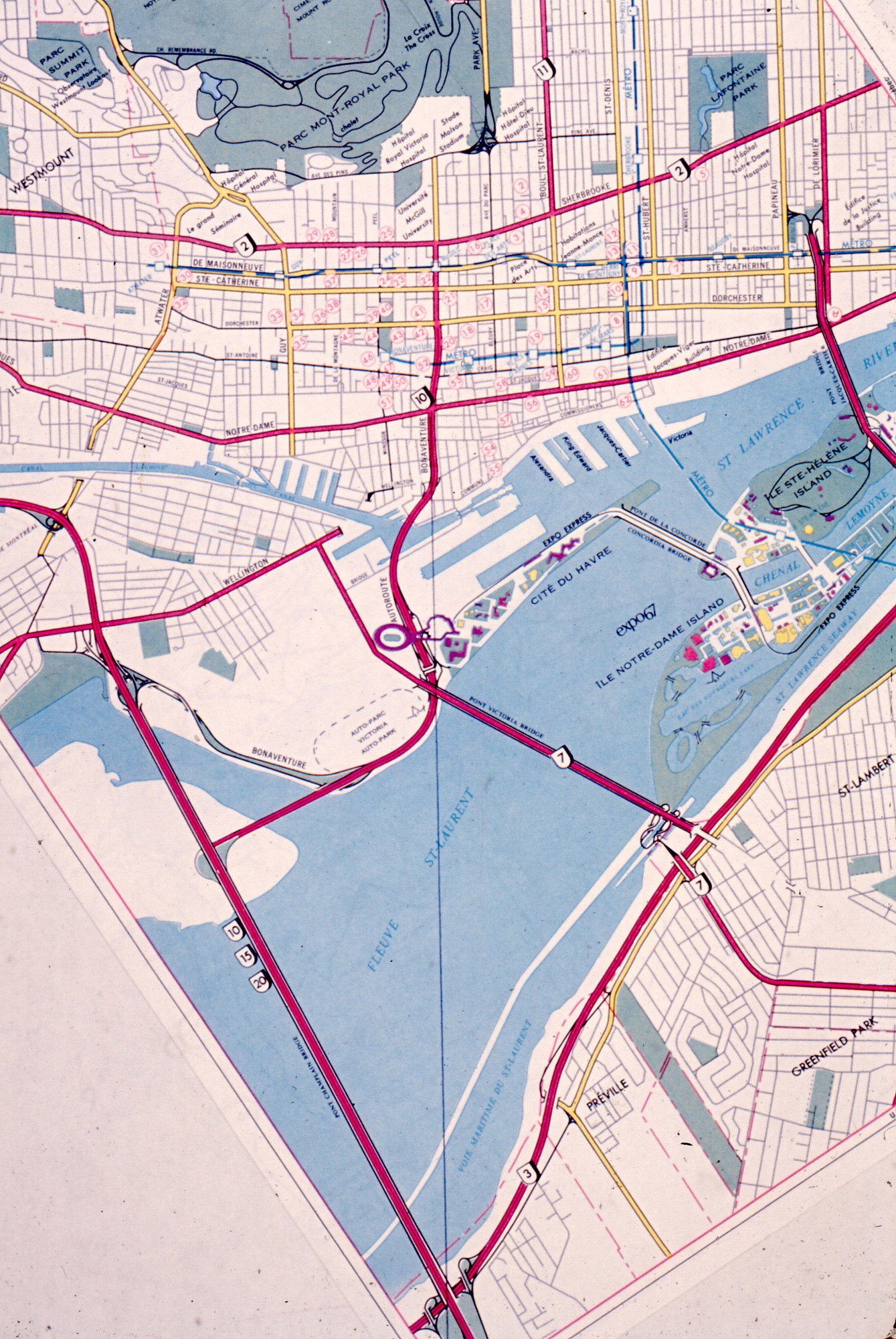
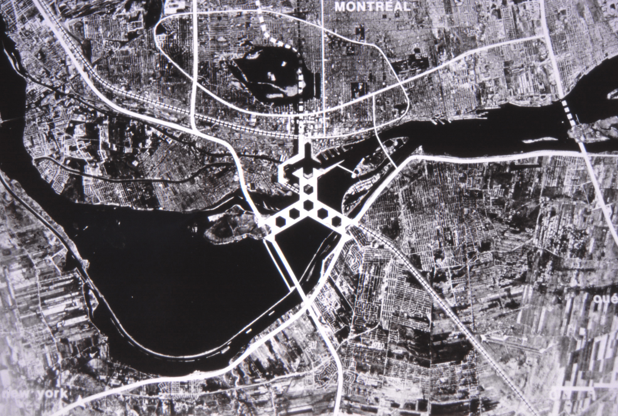
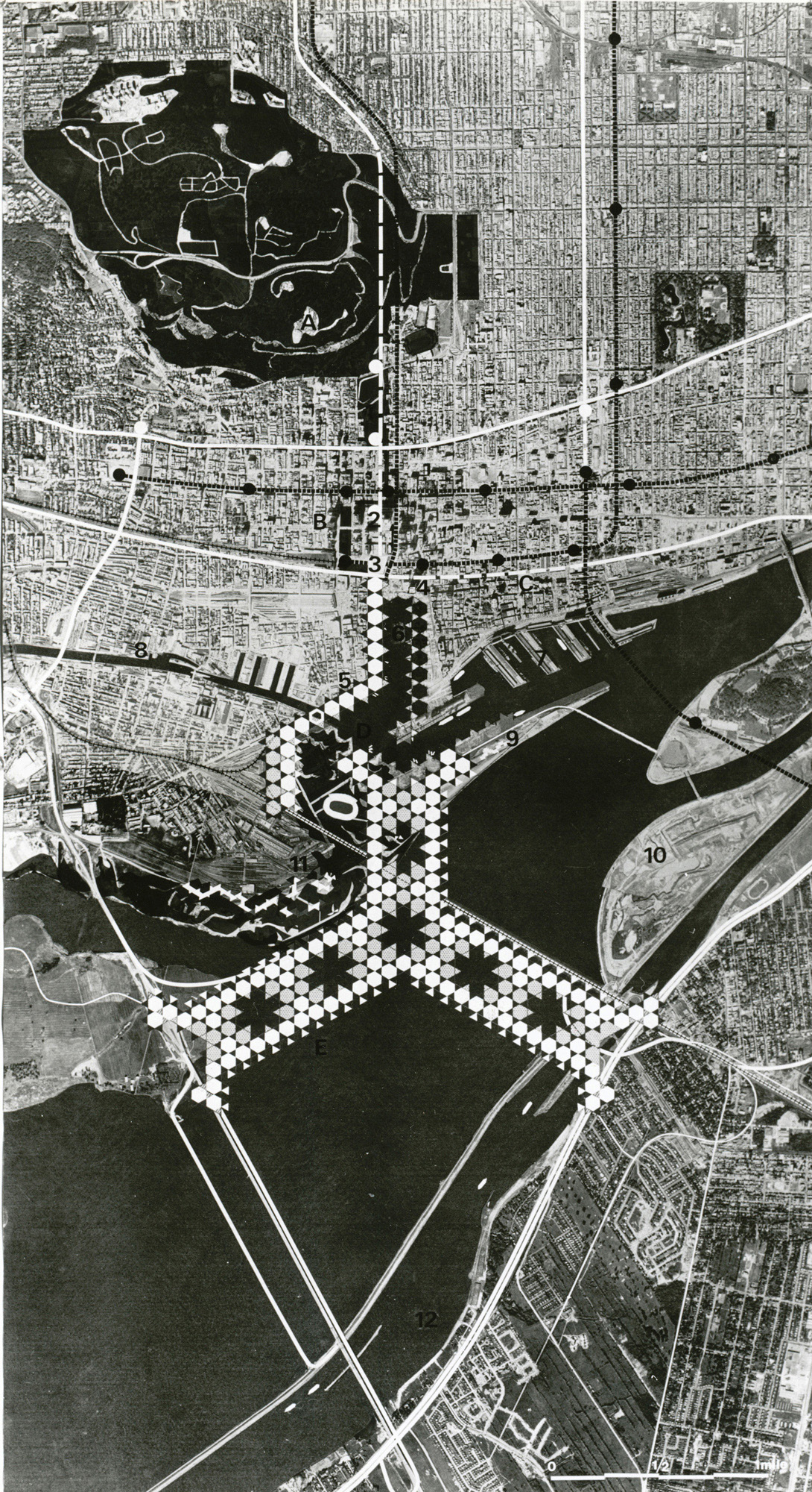
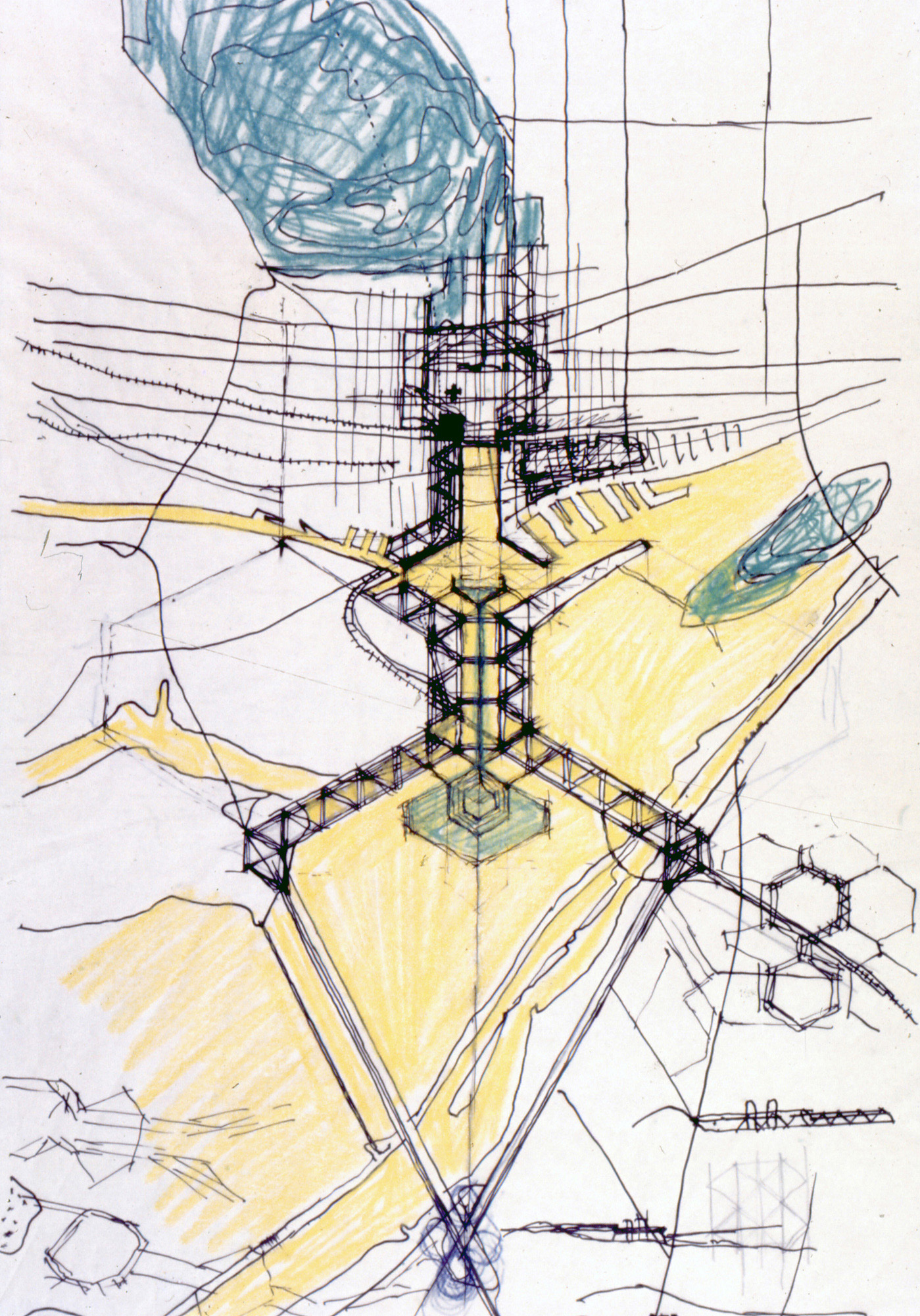
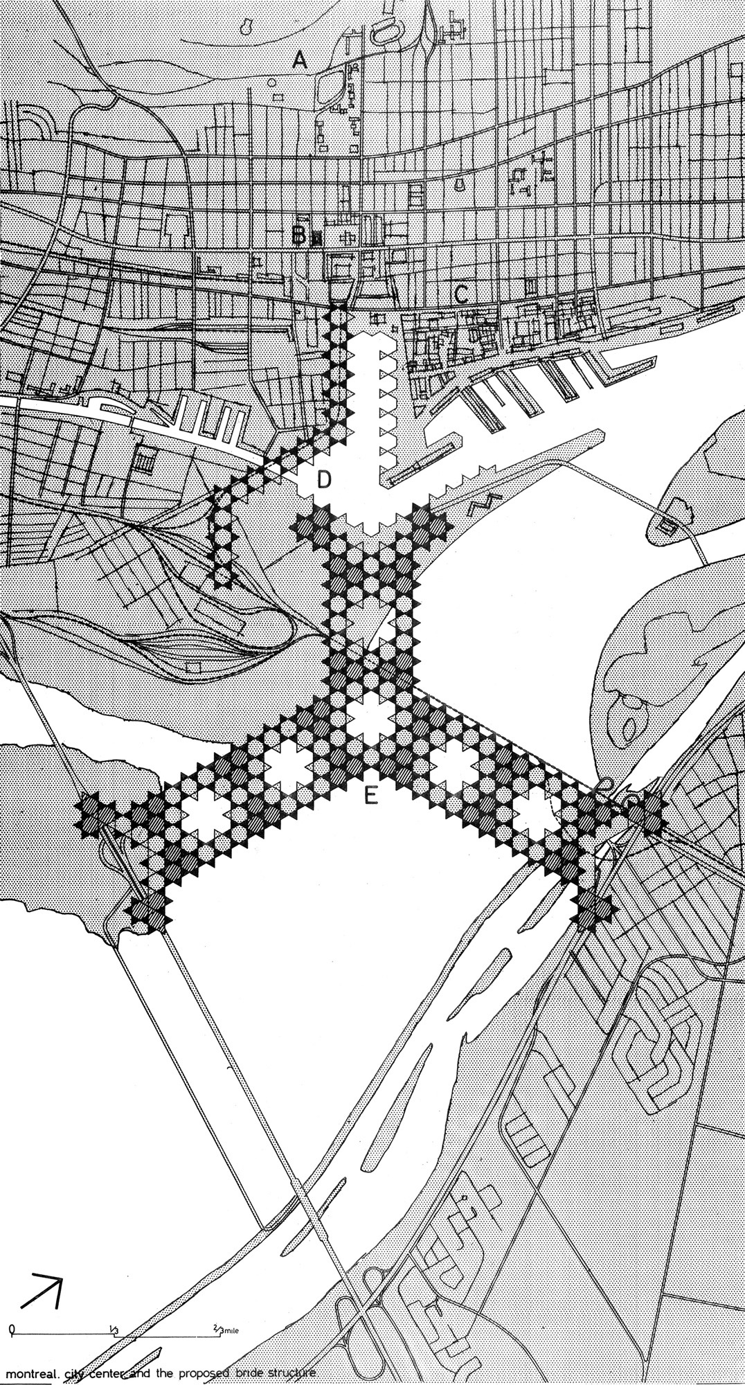
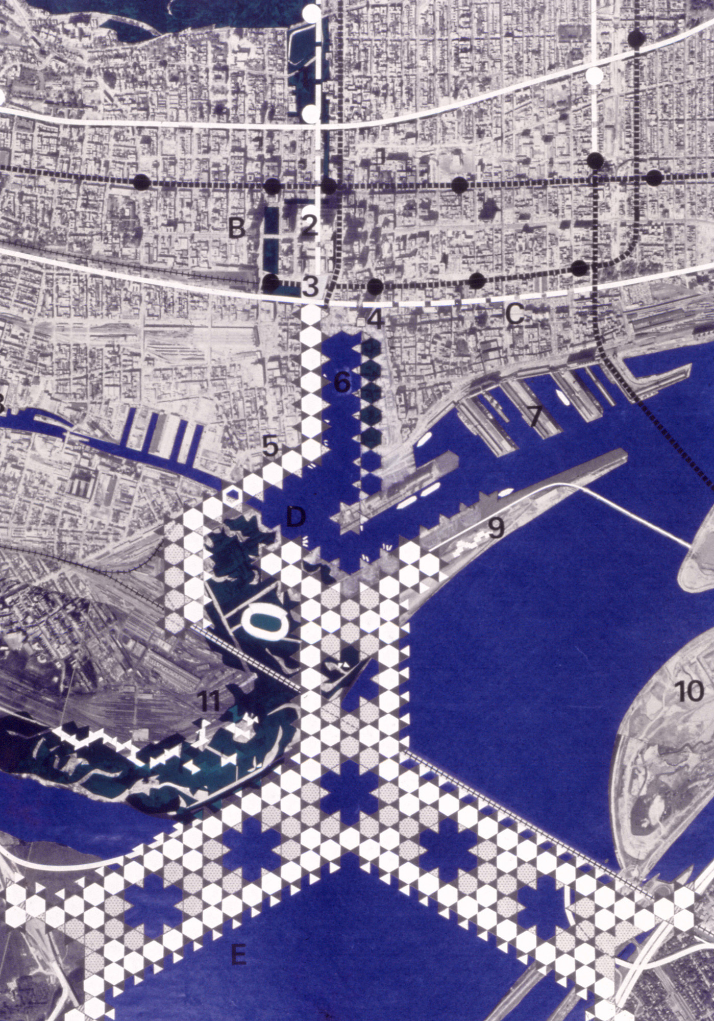
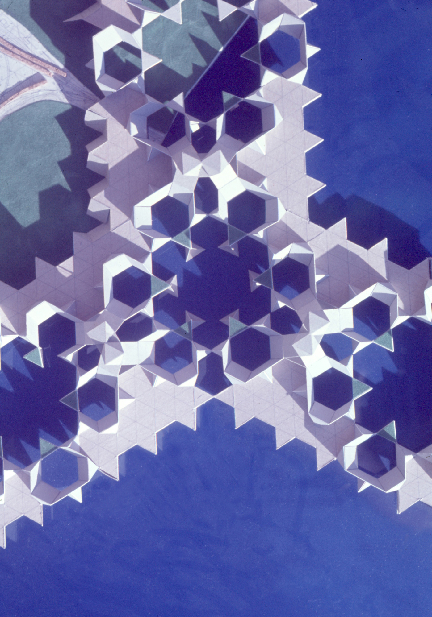
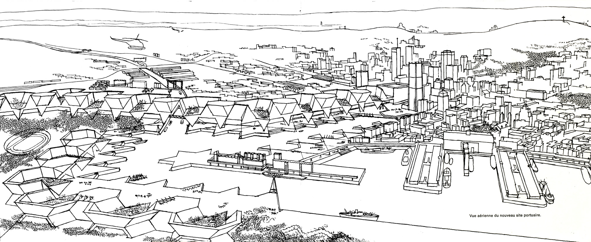
The proposed scheme calls for the establishment of an integrated backbone-like structure for the down-town area of Montreal. The scheme imposes a kind of spinal axis, which will link the centre with both Mount Royal and the St. Laurence River. The axis of this scheme will run along University Street, perpendicular to the main traffic and commercial arteries like Sherbrook, Ste. Catherine, and Dorchester Boulevard. It will bring the existing street network of the downtown area into a much more direct relation with the city core and the water front. By reclaiming the deteriorating land below Place Victoria, the St. Laurence River can be brought up to the very centre of Montreal. This land will be reshaped and a canal cut into it, so as to equip the centre with a new shoreline, marinas and waterfront elements converting the area into the city's major recreational and scenic backdrop. Along the canal axis a large basin will be created at the place of today's harbour, liberating the city from the view-blocking facilities of the port. This basin opening a view on old Montreal will be largely enclosed by a continuous 20-storey high structure, creating rather dense habitation around a luxury water space. This basin will restore the link between the Lachine Canal and the St. Laurence River, a link which is today obsolete but might be revived for recreational purposes. The structure around the basin continues down to the River where it spreads into two bridges, one above the actual Victoria Bridge and the other along the Bonavanture Highway to the point where it reaches the Champlain Bridge. Both structures will contain habitation, communication and commercial multi-purpose spaces.
The whole scheme will provide the city with a new urban surrounding within the radius of its centre but on the opposite side of the existing agglomeration. Without destroying the existing urban fabric by costly and usually unsuccessful rehabilitation projects, new residents might be accommodated to enrich the dynamism and vitality of the centre.
The scheme will also help to solve the transportation problem along the existing lines of communication. The Victoria and Champlain bridges and the Bonaventure highway will be enlarged in size and traffic capacity as an integrated part of the architectural scheme, instead of the usually adapted independent traffic solutions which above all create new environmental problems. The proposed scheme eliminates new highways and high-speed vehicular traffic within the downtown area of the city. Tunnels will carry highway routes under the centre and the Mount Royal area providing a direct connection between the south-east shore of the St. Laurence River, where Quebec, Sherbrook and United-States roads meet - and the Laurentian autoroute on the other side of the Island where the new airport of St. Scholastique will be located.
This proposal deals necessarily with specific goals rather than with particular details. By harnessing the various independent forces working within the city frame toward a common aim, we might exploit this particular moment of Montreal's development to outline a future coherent form.
"The centre of Montreal is large enough to accommodate its present and future functions, if organized in an orderly way. One may still walk on foot across the centre and enjoy its vitality, but one lacks the necessary sense of direction. The longitudinal streets marking Montreal´s character are endless parallels reaching no destination. A spinal column for Montreal is a necessity just as it is for any large organism.
In Montreal, an immense sea-port has closed itself from the water which was its cradle. No one benefits from its beauty, its spaciousness and its movement. The St. Laurence River must become once more the mirror of Montreal in which the city should look for its reflected image."

Client:
University Laval, School of Architecture
Competition:
1965